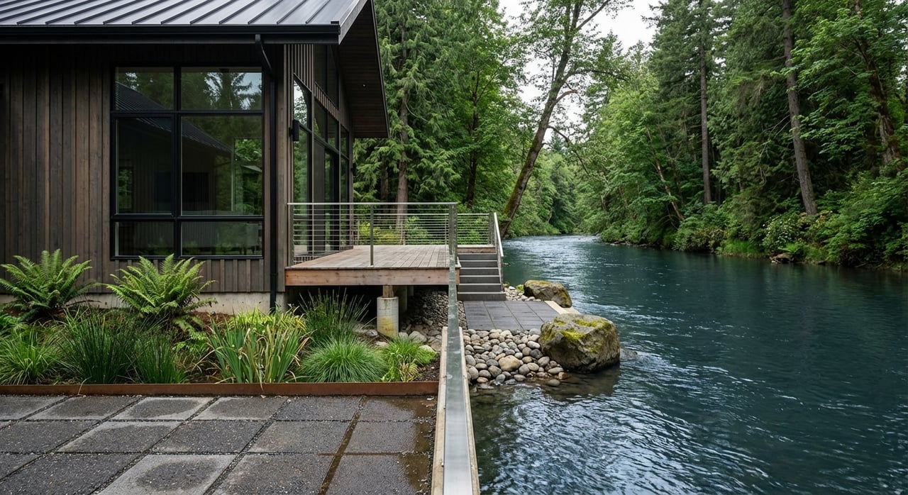
Imagine waking up to a rushing river or a panoramic Gorge view, coffee in hand, and the day already feeling lighter. If you’re drawn to Washougal’s water and hillside lifestyle, you also know there’s more to it than a pretty outlook. You want the full picture on flood maps, shoreline rules, slope stability, insurance, utilities, and what affects price. This guide breaks down the key tradeoffs so you can buy with confidence and enjoy the view without surprises. Let’s dive in.
Why Washougal river and view homes
Washougal offers quick access to the Portland–Vancouver metro and the Columbia River Gorge, plus a laid‑back, outdoorsy lifestyle. Townwide median home values often sit around the mid to high six figures, and riverfront or view properties typically command a premium due to limited supply. In recent years, many Washougal riverfront sales have landed in the roughly $500k to $1M+ range, while hillside or river‑view homes commonly range around $450k to $900k depending on views, lot size, and quality. Unique parcels and larger frontage can reach well into seven figures when improvements, access, and privacy align.
If you’re considering a second home or a primary retreat, think in terms of amenities versus obligations. You get everyday access to swimming, kayaking, sunsets, or big‑sky views. In return, you may manage added due diligence on flood, shoreline vegetation, geotechnical reports, or septic. The more prepared you are up front, the smoother your purchase and the better your long‑term enjoyment.
Floodplain 101 for river buyers
Flood risk is a core factor for any riverfront home. FEMA’s Flood Insurance Rate Maps (FIRMs) identify Special Flood Hazard Areas and floodways, which can affect insurance, financing, and future work on the property. Clark County adopts FEMA panels and provides local resources to verify a parcel’s mapped status.
- Start with Clark County’s page on Flood Insurance Rate Maps to see which panels cover your property. Use the county’s FIRM tools for local context.
- Pull a parcel‑specific map (a “FIRMette”) from FEMA’s Flood Map Service Center and note the flood zone and any mapped floodway.
- Review USGS flow history at the Washougal River gage to understand seasonal peaks and historical events.
Essential flood due diligence
- Identify the flood zone (AE, A, X, etc.) and the Base Flood Elevation if applicable. If the structure is in a mapped Special Flood Hazard Area, lenders with federal backing typically require flood coverage.
- Request any Elevation Certificate from the seller. If none exists, plan for a licensed survey to determine elevation relative to the BFE. If elevation data supports it, a Letter of Map Amendment or Revision might remove a structure or lot from the mapped flood zone. Learn about LOMA/LOMR on FEMA’s guidance.
- Ask about flood claims, bank erosion, and repairs. Combine seller disclosures with your own document checks and inspections so you understand both mapped and observed risk.
Insurance and financing basics
Standard homeowners policies do not cover flood damage. Flood insurance is separate and usually obtained through the National Flood Insurance Program or private carriers. NFIP policies usually have a 30‑day waiting period before coverage starts, with limited exceptions when a lender requires coverage for closing. Explore policy details and timelines through FEMA’s flood insurance resources.
Premiums vary based on your flood zone, building elevation relative to the BFE, and the home’s construction and foundation type. Many claims occur outside mapped SFHAs, so you might consider a policy even if a FIRM shows lower risk. Get quotes early so you can model total monthly cost with your lender before you make an offer.
Shoreline rules you should know
In Washington, shoreline jurisdiction typically extends 200 feet landward from the ordinary high‑water mark, plus floodways and associated wetlands. Local Shoreline Master Programs implement these rules and can affect vegetation management, bank work, and most construction near the river. Washougal is actively updating its SMP, and the city provides owner resources and permit guidance. Review the City’s Shoreline Master Program update page to understand designations, setbacks, and permit types.
- In‑water or near‑bank work such as bank stabilization or docks often requires a Hydraulic Project Approval from the state. Learn about HPAs and best‑practice bank protection through WDFW’s program page.
- Some projects also involve federal review through the U.S. Army Corps and state Department of Ecology processes. Plan for layered permits, timing, and possible mitigation.
Bottom line: shoreline rules help protect habitat and public resources. They also create a permitting pathway for improvements when designed and documented correctly. Expect to coordinate early with the city and qualified consultants.
Hillside stability and view lots
View homes on Washougal’s slopes trade light and vistas for geotechnical due diligence. Steep or mapped hazard areas can require site evaluations, buffers, and geotechnical reports for construction or major improvements. Washougal’s critical‑areas code outlines when a geotech report is necessary and what development standards apply. Review the city’s critical‑areas regulations to understand potential constraints.
Consider two cost streams with hillside value: upfront development limits and studies, plus long‑term maintenance. Retaining walls, drainage control, erosion repairs, and tree management can be ongoing line items. A clear geotechnical opinion can also help your lender and insurer price risk appropriately.
Scenic Area checks
Parts of the Columbia River Gorge near Washougal sit inside the Columbia River Gorge National Scenic Area. If a parcel lies within that boundary, additional design standards, allowable uses, and review steps can apply. Before you fall in love with a view parcel, verify whether the Scenic Area overlay applies and how it might affect your plans. Your agent can help you confirm the boundary and flag any known rulings or appeals in the area.
Utilities, septic, and access
Not every river or ridge parcel connects to city utilities. Washougal operates a municipal water system and maintains sewer and water plans, but some properties still use private wells and septic systems. Confirm service availability with the City’s Public Works team and review public documents on Water Operations before you write an offer.
If the home is on septic, ask for recent inspection and maintenance records. Clark County Public Health tracks onsite sewage compliance and inspection schedules, and sellers must disclose known system details. For policy details and possible fees, start with the county’s onsite sewage program page.
River and hillside homes often rely on private or shared driveways. Verify legal access, recorded easements, and road maintenance agreements. Clarify who maintains steep or gravel segments and how winter conditions affect service. These practical items shape everyday livability and may influence your insurance and lender requirements.
Price ranges and real tradeoffs
While every property is unique, recent local patterns provide helpful anchors:
- Riverfront with direct frontage: Often around $500k to $1.2M+, with larger or especially private tracts reaching above $1M.
- River‑view or hillside without frontage: Commonly $450k to $900k, often clustering around town median values when views, lot size, and recent construction align.
- Entry‑level or seasonal river parcels: Select mobile or small lots can trade much lower, but you must verify access, utility status, and any seasonal use limits.
How price connects to risk and amenities:
- Long frontage, private access, and newer improvements tend to push values higher.
- Flood zone status, elevation, and bank stability influence insurance, maintenance, and financing.
- On hillside lots, required geotech studies and retaining work add to total cost of ownership. Strong views can offset those costs at resale when documentation is in place.
Smart evaluation checklist
Use this quick checklist to compare riverfront and view listings side by side:
Flood and elevation
- Pull a FIRMette and mark the flood zone and any floodway from FEMA’s Map Service Center. Cross‑check panels at Clark County FIRM resources.
- Ask for an Elevation Certificate or plan a new survey. If appropriate, discuss LOMA/LOMR options with your surveyor.
Shoreline and riverbank
- Confirm whether past bank work or docks were permitted and what approvals may be needed for repair or replacement. See guidance for HPAs at WDFW and SMP requirements at the City’s SMP page.
Hydrology and history
- Review historical flows and peak events on the USGS gage. Ask the seller about known high‑water events, bank erosion, and repairs.
Soils and slopes
- If sloped or mapped as a hazard, request any geotechnical reports and check the city’s critical‑areas regulations to see what studies or buffers apply.
Insurance and lending
- Get flood insurance quotes early and confirm lender requirements. Learn coverage basics at FEMA’s flood insurance page.
Utilities and wastewater
- Verify city water/sewer availability with Washougal Water Operations. If on septic or well, gather inspection records and check Clark County’s OSS program.
Access and easements
- Confirm legal road access, shared driveway agreements, and winter maintenance responsibilities. Ask your title officer to flag utility and riparian easements.
Scenic Area overlay
- Determine if the parcel lies within the Gorge Scenic Area. If yes, expect additional design standards and review steps.
Buy with confidence
The magic of a Washougal river or view home is real. When you pair that lifestyle with clear due diligence, the experience becomes both beautiful and practical. If you would like a tailored short list of riverfront or hillside opportunities, help deciphering flood and shoreline maps, or introductions to trusted surveyors, geotechs, and inspectors, reach out to Louise James. You will get personal guidance that blends local insight with elevated, end‑to‑end service.
FAQs
What is a FEMA flood map and why does it matter in Washougal?
- A FEMA Flood Insurance Rate Map shows your property’s flood zone and whether it is in a Special Flood Hazard Area, which affects insurance and lending; you can check your parcel at FEMA’s Map Service Center and Clark County’s FIRM resources.
How do I estimate flood insurance for a Washougal riverfront home?
- Premiums depend on your flood zone, elevation relative to the base flood elevation, and building features; get quotes early and review coverage basics on FEMA’s flood insurance page.
What permits are required to repair a riverbank or add a dock?
- Many near‑bank or in‑water projects need a state Hydraulic Project Approval and a shoreline permit under the city’s Shoreline Master Program, with possible federal review depending on scope.
What should I verify about septic or utilities on a hillside lot?
- Confirm city water and sewer availability with Washougal Public Works; if on septic, request recent inspection records and review Clark County’s onsite sewage program for maintenance requirements.
Are Washougal view homes inside the Gorge Scenic Area regulated differently?
- Some parcels are inside the Columbia River Gorge National Scenic Area and can be subject to added design standards and review, so verify the boundary early in your due diligence.
How do prices compare for riverfront versus hillside homes?
- Riverfront homes often range about $500k to $1.2M+ depending on frontage and improvements, while hillside or river‑view homes commonly range about $450k to $900k based on view quality, lot size, and construction.